

Brandon Hill [Cnoc Bhreanail]
Good walks are even better shared.
S6940 : Car Park Guide
kevin higgins Photo source
Overview
Brandon Hill [Cnoc Bhreanail]
Introduction
Nestled in the serene beauty of the Brecon Beacons, Brandon Hill, or Cnoc Bhreanail as it's known in Welsh, stands proudly at an elevation of 511 meters. This Marilyn hill offers outdoor enthusiasts a blend of stunning views, accessible hiking routes, and a dose of genuine Welsh charm.
Geology
Comprising predominantly Old Red Sandstone, the hues of Brandon Hill reflect the timeless geological processes that have shaped this picturesque landscape. Look closely and you may spot fossilised remains of ancient marine life—just don't forget your magnifying glass!
Routes
The most popular route to the summit is the Brandon Hill Circular Route, which spans approximately 7.5 km. Allow about 2.5 hours for a moderate trek that grants you ample opportunity to soak in the immersive beauty surrounding the hill. Along the path, you're likely to encounter verdant grassy slopes interspersed with rocky outcrops. Just be wary of the boggy patches that may surprise you like an uninvited guest!
Summit Features
At the summit, adventurers will find a sizeable cairn and a trig point marking the apex of the hill. Whether you fancy a group photo or a solitary moment of reflection, this spot is ideal for both. Plus, the panoramic views from this vantage point will have you questioning why you hadn't visited sooner!
Terrain
The terrain on Brandon Hill is a delightful mix of grassy expanses and rugged rocky areas. Do bear in mind several boggy spots—Mother Nature’s little sponge! A sturdy pair of hiking boots will serve you well, while flip-flops should probably stay home.
Views
Once at the top, prepare for your breath to be taken—by both the altitude and the sight! Your eyes will feast on splendid vistas, including the mighty Pen y Fan to the north and the lush Usk Valley unfurling below. Spring is the best season to visit for colourful wildflowers, while Autumn showcases a magnificent tapestry of golds and browns.
Hazards
As with many hikes, be mindful of the possible hazards. Slippery rocks are common after rains, and sudden weather changes can catch the unprepared hiker off guard—so always check the forecast before you head out and pack accordingly.
Nearby Summits
If you’re feeling particularly adventurous, consider adding a few extra summits to your itinerary. Talybont Beacon, standing at 600 meters, and the majestically towering Pen y Fan at 886 meters are both nearby and commanding significant views all around.
Access
Getting to Brandon Hill is relatively easy. The nearest parking can be found at the National Trust car park located at the base of the hill, which fills up quickly on sunny weekends. Public transport options include bus services connecting nearby towns like Brecon and Abergavenny, making this little adventure accessible even if you’re sans car.
Facilities
Fortunately, once you’ve descended, Brecon is at your service with plenty of cafes and pubs to replenish your energy. Whether you fancy a hearty meal or a quick cup of tea, you’ll have several options at your fingertips, not to mention toilet facilities!
History
As for its name, 'Cnoc Bhreanail' translates to 'Hill of the Heather', a nod to the beautiful flora that carpets its slopes. Historically, this hill has held cultural significance in Welsh folklore, enriching your hike with a sprinkle of magical tales.
In conclusion, if you’re looking for a hike that checks all the boxes—stunning views, accessible routes, and a touch of history—look no further than Brandon Hill. So grab your walking boots, pack some snacks, and enjoy a splendid day out in the Bosom of the Brecon Beacons.
Happy hiking!
Explore routes near Brandon Hill [Cnoc Bhreanail]
Walks starting near this hill. Open a route to check its map, distance and full itinerary.
Route planning notes
These notes describe possible approaches. Check a route's map and access information when planning your walk.
Brandon Hill Circular Route
A popular circular walk starting from the east side of the hill, offering stunning views and a manageable ascent.
Make a day of it, together
Find someone to share the walk with, or organise a day out along a route you like.
Photo Gallery
View all Photo could not load
S6940 : Car Park Guide
kevin higgins
 Photo could not load
S6940 : Summit Cross
kevin higgins
 Photo could not load
S6940 : Ritual Site
kevin higgins
 Photo could not load
S6940 : Summit Cross
kevin higgins
 Photo could not load
S6940 : Trig Pillar and Mound
kevin higgins
 Photo could not load
S6940 : Trig point and cross at the summit of Brandon Hill
Bill Griffiths
 Photo could not load
S6940 : Misty Summit
kevin higgins
 Photo could not load
S6940 : Brandon Hill
kevin higgins
 Photo could not load
S6940 : Brandon Hill Summit just S of Graiguenamanagh, Co Kilkenny
Colin Park
Hill facts and local notes
Classifications
Elevation
515m
1,690 ft
Prominence
448m
Coordinates
52.5098, -6.9742
S697402
OS Map
68
At the Summit
The summit features a large cairn and a trig point, providing a perfect photo opportunity and a place to enjoy the expansive views.
Terrain & Geology
Brandon Hill is primarily composed of Old Red Sandstone, giving the area a distinct reddish hue and adding to its scenic beauty.
Views & Scenery
Incredible views of the central Brecon Beacons, including Pen y Fan and the lush Usk Valley.
History & Heritage
Name Origin
The name 'Cnoc Bhreanail' translates from Welsh to 'Hill of the Heather'.
Historical Significance
Brandon Hill has cultural significance in local folklore and has been a beloved walking destination for centuries.
Getting There & Facilities
Parking
The nearest parking is at the National Trust car park at the base of the hill, which has ample space and is usually busy on weekends.
Public Transport
Regular bus services connect to nearby towns such as Brecon and Abergavenny.
Nearby Facilities
Several cafes and pubs in Brecon offering hot meals and refreshments, as well as toilet facilities.
Safety Information
Known Hazards
- Potentially slippery rocks, particularly after rain. Beware of sudden weather changes common in the area.
General Safety Tips
- Check weather conditions before setting out
- Carry appropriate clothing and equipment
- Let someone know your planned route
- Take a map, compass, and GPS device
- Carry emergency supplies: food, water, first aid kit, torch
Hills
Some common questions about the hills answered
Are there group walks up Brandon Hill [Cnoc Bhreanail]?
Many walkers use Walkmates to join or organise walks with others. You can check for group walks around Brandon Hill [Cnoc Bhreanail] through the maps
Are there other walkers around Brandon Hill [Cnoc Bhreanail]?
Activity varies by location and time, but Walkmates lets you see whether others have shared walks or shown interest in this area. Find other people through the walking friends search walking friends for Brandon Hill [Cnoc Bhreanail] search or of course create your own walk for Brandon Hill [Cnoc Bhreanail]
Can I organise a walk to Brandon Hill [Cnoc Bhreanail]?
Yes. If there aren’t any walks listed already, you can create a walk and make it available for others to join.
If you're signed up to Walkmates, you can create a walk to Brandon Hill [Cnoc Bhreanail].
How do I find a walk up this hill?
There are often multiple ways to walk this hill, depending on experience and route preference. Walkmates helps you explore walks and routes that others have shared.
Can I suggest a new route up Brandon Hill [Cnoc Bhreanail]?
Yes. You can suggest or create routes to share with others. Walkmates focuses on the social side of walking, so routes are used to help people organise walks and explore areas together, rather than as detailed navigation tools or route libraries.
Other uses really appreciate knowledgeable walkers sharing their routes. Share your favourite route to Brandon Hill [Cnoc Bhreanail] here
The is an error or something incorrect about this hill. How do I let you know?
We always strive to keep the information on Walkmates as accurate as possible. If you find an error, please let us know through the contact form and we'll aim to correct it as quickly as possible
Community Discussion
Comments
Location
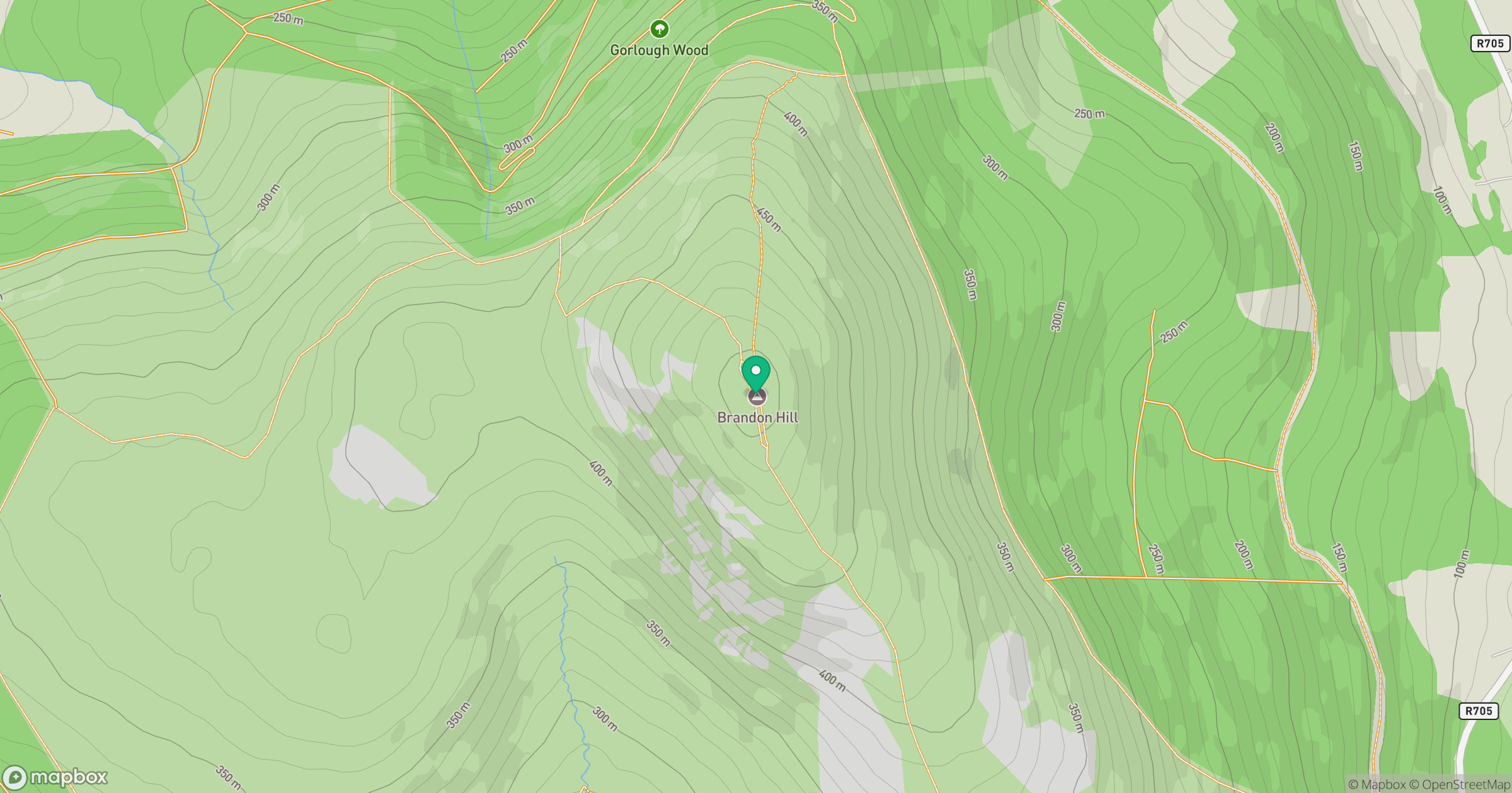
Grid reference: S697402
View on OpenStreetMapOpens a map in a new tab, centred on the hill.
No comments yet. Be the first.